
Wir senden dir das abgebildete Buch

Mehr zum Buch
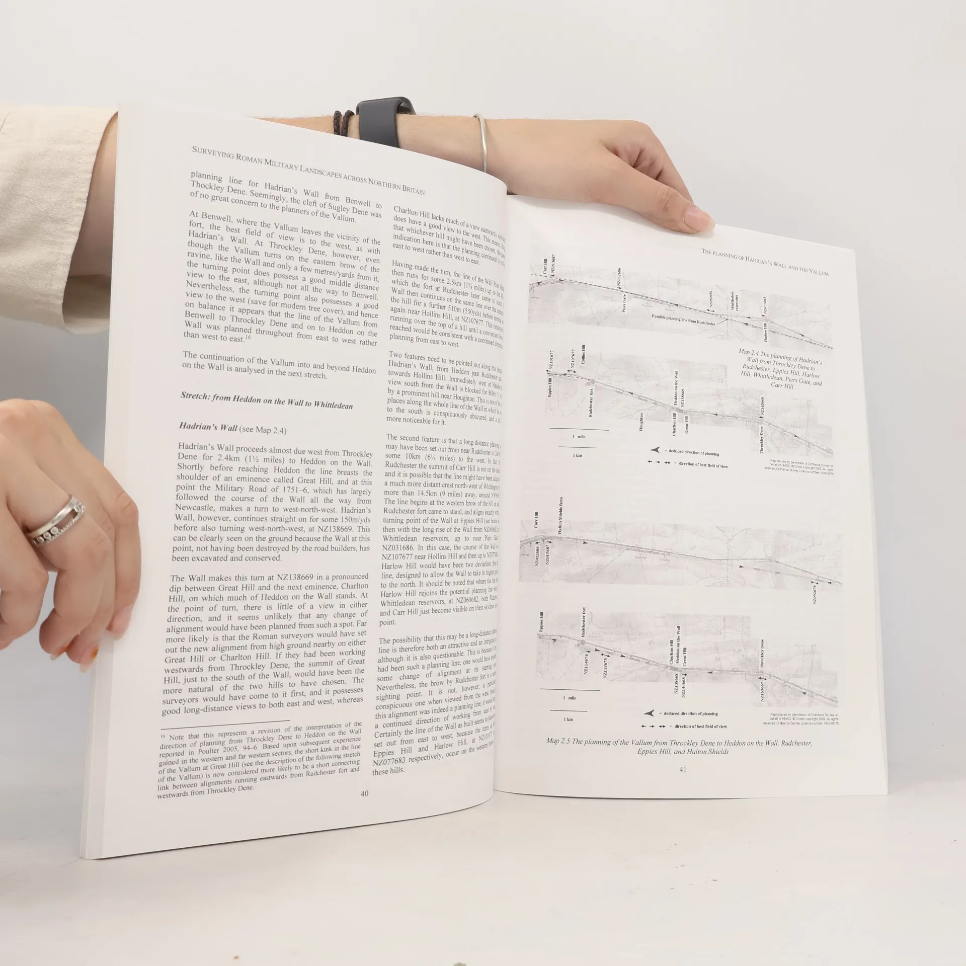
Surveying Roman Military Landscapes across Northern Britain. Preface (David J. Breeze); Introduction (John Poulter); Report No. 1: The Planning of Roman Dere Street from the Vale of York to Newstead by the Tweed (John Poulter); Report No. 2: The Planning of Hadrians Wall and the Vallum (John Poulter); Report No. 3: The Planning of the Antonine Wall in Scotland (John Poulter); Supplementary Mapping Matters with the Antonine Wall (Peter McKeague).
Buchkauf
Surveying Roman Military Landscapes across Northern Britain, John Poulter
- Sprache

- Erscheinungsdatum
- 2009
- product-detail.submit-box.info.binding
- (Paperback),
- Buchzustand
- Gebraucht - Sehr gut
- Preis
- € 26,49
Keiner hat bisher bewertet.
- Titel
- Surveying Roman Military Landscapes across Northern Britain
- Untertitel
- The Planning of Roman Dere Street, Hadrian's Wall and the Vallum, and the Antonine Wall in Scotland
- Sprache
- Englisch
- Autor*innen
- John Poulter
- Erscheinungsdatum
- 2009
- Einband
- Paperback
- Seitenzahl
- 141
- ISBN10
- 1407305190
- ISBN13
- 9781407305196
- Reihe
- Schlagwörter
- Sachbücher, Geschichte, Militärgeschichte, Großbritannien, Altertum, Römisches Reich
- Beschreibung
- Surveying Roman Military Landscapes across Northern Britain. Preface (David J. Breeze); Introduction (John Poulter); Report No. 1: The Planning of Roman Dere Street from the Vale of York to Newstead by the Tweed (John Poulter); Report No. 2: The Planning of Hadrians Wall and the Vallum (John Poulter); Report No. 3: The Planning of the Antonine Wall in Scotland (John Poulter); Supplementary Mapping Matters with the Antonine Wall (Peter McKeague).